ISDE International Lectures, organized by the International Society for Digital Earth (ISDE) are a series of online events which feature invited lectures by well-known international experts in the field of Digital Earth. The purpose of the events is to bring international scholars in the relevant research fields of Digital Earth together to exchange academic perspectives, share research results, and disseminate the most cutting-edge and authoritative concept of Digital Earth.
The 16th ISDE International Lectures
The 16th ISDE International Lectures, with the theme of "GeoAI for Intelligent Earth Observation", will invite three speakers to explore the diverse functions, capabilities, and practical applications of GeoAI in advancing more efficient and intelligent geospatial analysis and Earth observation.
Theme: GeoAI for Intelligent Earth Observation
Date & Time: 10th July, 2025, 8:30-10:00 AM (Eastern Standard Time)
10th July, 2025, 8:30-10:00 PM (China Standard Time)
Organized by: International Society for Digital Earth
Supported by:
International Research Center of Big Data for Sustainable Development Goals
International Journal of Digital Earth
Big Earth Data
Invited Speakers:
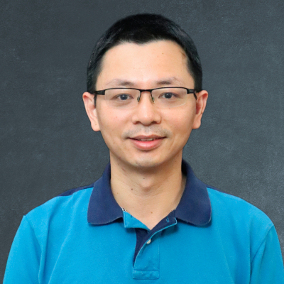
Di Yang (University of Florida, USA)
Qiusheng Wu (University of Tennessee, Knoxville, USA)
Xiao Huang (Emory University, USA)
Moderator:
Xiao Huang (Emory University, USA)
Programme:
Time Zone (Eastern Standard Time, EST) | |
8:30-8:35 | Welcome and Introduction |
8:35-8:55 | Topic: Advanced Methodologies for Integrating Crowdsourced Environmental Data with Remote Sensing Technologies Speaker: Di Yang (University of Florida, USA) |
8:55-9:15 | Topic: An Introduction to the GeoAI Python Package: Bridging AI and Geospatial Analysis Speaker: Qiusheng Wu (University of Tennessee, Knoxville, USA) |
9:15-9:35 | Topic: Beyond Pixels: Semantic Understanding of Remote Sensing Imagery with AI Captioning and Foundation Models Speaker: Xiao Huang (Emory University, USA) |
9:35-10:00 | Group Photo Q&A |
Zoom Link:
https://us06web.zoom.us/j/88673312907?pwd=TO06sEvalXw25UklQPV6KNFbCavzKO.1
ID: 886 7331 2907, Password: 824523
Contact:
ISDE Secretariat (Email: isde@radi.ac.cn, Tel.: 86-10-82178912)
Short Bio of Invited Speakers:

Di Yang
University of Florida, USA
Dr. Di Yang is an Assistant Professor in the Department of Geography at the University of Florida, specializing in advanced geospatial artificial intelligence applications integrated with multi-source Earth observation systems. Her research focuses on cloud-based big data analytics, citizen science integration, and human-environment interaction modeling using cutting-edge GeoAI methodologies, with particular emphasis on climate-driven ecosystem monitoring and environmental change detection. Dr. Yang has secured substantial research funding as Principal Investigator through highly competitive NASA programs, including prestigious Early Career Research Awards, while serving as Senior Personnel on major research initiatives spanning NSF Major Research Instrumentation acquisitions, NSF Engine and multi-institutional NASA Earth Science partnerships, demonstrating sustained excellence in convergent research proposal development that integrates geospatial artificial intelligence, Earth system science, and environmental monitoring across collaborative networks involving multiple universities and agencies. Dr. Yang develops innovative frameworks that leverage Earth System models integrated with citizen science data and advanced AI architectures for applications ranging from mosquito-borne disease forecasting to forest ecosystem vulnerability assessment. Her technical expertise spans enterprise-scale geospatial analytics using Google Earth Engine, AWS, Azure, and high-performance computing clusters, with proficiency in machine learning implementations, deep learning frameworks, and cloud-native geospatial application development. Dr. Yang has authored 45+ peer-reviewed publications in top ranking journals, while serving on the editorial board of Nature Scientific Reports, demonstrating proven expertise in translating complex geospatial AI research into operational environmental monitoring solutions. She holds a Ph.D. in Geography from the University of Florida and M.S. in Environmental Engineering from Texas A&M University-Kingsville.

Qiusheng Wu
University of Tennessee, Knoxville, USA
Dr. Qiusheng Wu is an Associate Professor and the Director of Graduate Studies in the Department of Geography & Sustainability at the University of Tennessee, Knoxville, USA. He also serves as an Amazon Scholar. Dr. Wu's research focuses on geospatial data science and open-source software development, with an emphasis on leveraging big geospatial data and cloud computing to study environmental change, particularly surface water and wetland inundation dynamics. He is the creator of several widely used open-source Python packages, including geemap, leafmap, segment-geospatial, and geoai, which support advanced geospatial analysis and interactive visualization. His open-source work is available at https://github.com/opengeos.

Xiao Huang
Emory University, USA
Dr. Xiao Huang is an Assistant Professor in the Department of Environmental Sciences at Emory University, USA. His research expertise encompasses human-environment interaction, computational social sciences, urban informatics, disaster mapping and mitigation, GeoAI, and disaster remote sensing. Dr. Huang has contributed extensively to his field with nearly 6000 Google Scholar citations, authoring over 250 peer-reviewed journal articles, over 20 book chapters, and playing a pivotal role in editing five books. He is among the World’s Top 2% Scientists by Stanford/Elsevier's rankings. In his professional capacity, he serves as an Associate Editor for Computational Urban Science and Journal of Remote Sensing, and is a member of the Editorial Board for several prestigious journals. Dr. Huang's research has garnered significant attention and received coverage in renowned media outlets such as Nature News, NASA, NBC, and Fox. His work has attracted substantial funding from NSF, NASA, the Bill & Melinda Gates Foundation, the National Academies, and the Centers for Medicare and Medicaid Services.
Moderator:

Xiao Huang
Emory University, USA
Extended Materials:
About the previous ISDE International Lectures:
https://www.digitalearth-isde.org/list-34-1.html
Open Geospatial Solutions: Open-source software packages for geospatial community:

2004-2026 All Rights Reserved 京ICP备06045536号-1 京公网安备 11010802041631号