NEWS


ISDE International Lectures, organized by the International Society for Digital Earth (ISDE), are a series of online events that feature invited lectures by well-known international experts in the field of Digital Earth. The purpose of the events is to bring international scholars in the relevant research fields of Digital Earth together to exchange academic perspectives, share research results, and disseminate the most cutting-edge and authoritative concepts of Digital Earth.
The 22nd ISDE International Lectures
The 22nd ISDE International Lectures will focus on the theme “AI-Enabled Geospatial Fusion for Sustainable Mapping and Urban Mobility.” Three invited speakers will present recent advances in AI-enabled mobile mapping, hyperspectral remote sensing for geological mapping and mineral exploration, and spatio-temporal analysis of urban traffic. The session will highlight how geospatial technologies, AI, and Earth Observation support data accessibility, sustainable infrastructure and resource management, and urban sustainability.
Theme: AI-Enabled Geospatial Fusion for Sustainable Mapping and Urban Mobility
Date & Time: 16 September 2026, 15:00-16:30 (UTC+8)
Organized by:
International Society for Digital Earth
Mongolian Geospatial Association
Supported by:
International Research Center of Big Data for Sustainable Development Goals
International Journal of Digital Earth
Big Earth Data
Invited Speakers:
Bilguunmaa Myagmardulam (Toyama Prefectural University, Japan)
Boloroo Bayaraa (Mongolian Geospatial Association, Mongolia)
Usukhbayar Ganbaatar (Mongolian Geospatial Association, Mongolia)
Moderator:
Enkhjargal Natsagdorj (Mongolian Geospatial Association / Ulaanbaatar City Municipality, Mongolia)
Programme:
UTC+8 | |
15:00-15:05 | Welcome and Introduction |
15:05-15:25 | Speaker: Bilguunmaa Myagmardulam (Toyama Prefectural University, Japan) |
15:25-15:45 | Topic: Utilizing PRISMA Hyperspectral Satellite Data for Geological Mapping and Mineral Exploration Speaker: Boloroo Bayaraa (Mongolian Geospatial Association, Mongolia) |
15:45-16:05 | Topic: Spatio-temporal Analysis of Traffic Congestion to Address Urban Mobility Challenges in Ulaanbaatar, Mongolia Speaker: Usukhbayar Ganbaatar (Mongolian Geospatial Association, Mongolia) |
16:05-16:30 | Group Photo and Q&A |
Zoom Link:
https://us06web.zoom.us/j/81829420343?pwd=9GgaaoVEP77RWWQVL7tt0iD1liUOCi.1
ID: 818 2942 0343, Password: 505034
Contact:
ISDE Secretariat (Email: isde@radi.ac.cn, Tel.: 86-10-82178912)
Short Bio of Invited Speakers:
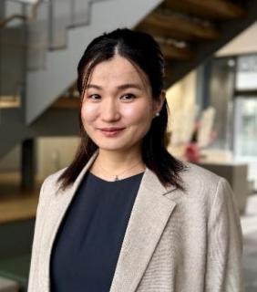
Bilguunmaa Myagmardulam
Toyama Prefectural University, Japan
Mongolian Geospatial Association
Bilguunmaa Myagmardulam is an Assistant Professor at Toyama Prefectural University, Japan. Her research focuses on low-cost mobile mapping systems, LiDAR-based sensing, and AI-driven geospatial modeling for Digital Earth applications. She develops integrated approaches combining LiDAR, GNSS/INS, and computer vision to enable scalable 3D environmental monitoring, particularly for road snow depth and infrastructure assessment. Her work also includes satellite remote sensing and environmental analysis. She has published in international journals and conferences, including the Asian Journal of Geoinformatics and IEEE Open Journal. Her current research explores AI-based depth estimation and multi-sensor fusion for cost-effective and accurate geospatial data generation.

Boloroo Bayaraa
Mongolian Geospatial Association
Boloroo Bayaraa holds a bachelor’s degree in exploration geophysics (2005–2009) from Mongolian University of Science and Technology, where she built a strong foundation in geological and subsurface analysis. She further enhanced her expertise by completing a postgraduate course in GIS and Remote Sensing at Indian Institute of Remote Sensing, gaining practical skills in geospatial data analysis and Earth observation. She has earned a master’s degree in Cartography from Eötvös Loránd University, with a focus on environmental monitoring using hyperspectral remote sensing, particularly in geological applications. Her research interests include lithological and surface material analysis, detection of hydrothermal alteration and mineralization zones, and the use of geospatial technologies for mineral exploration and geological interpretation.
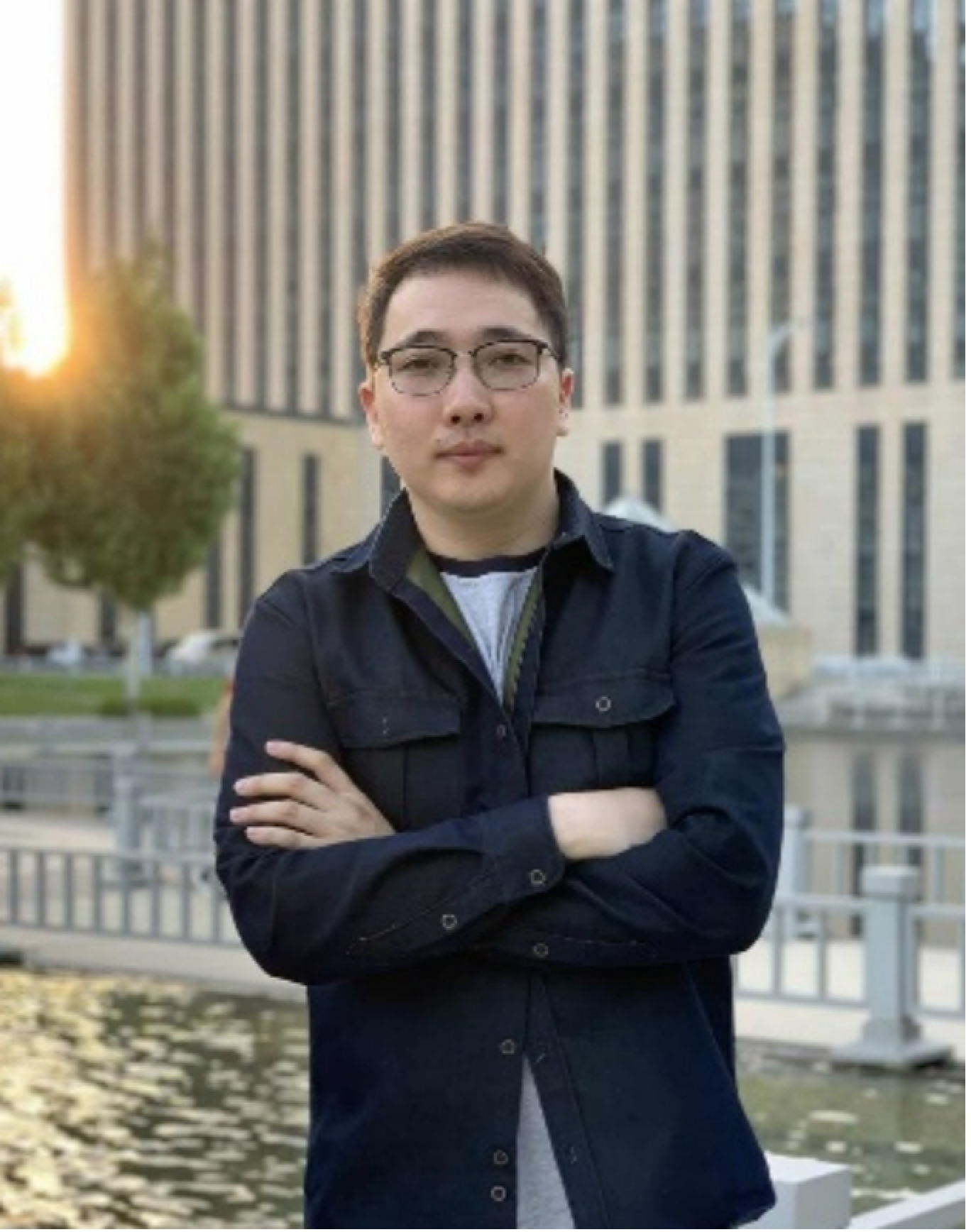
Usukhbayar Ganbaatar
Mongolian Geospatial Association
Ganbaatar Usukhbayar is a geospatial scientist specializing in Geographic Information Systems (GIS), remote sensing, and smart city technologies for sustainable urban development. Born in 1997 in Ulaanbaatar, Mongolia, he earned his bachelor’s degree in Land Management (Planning and Cadastre) from the National University of Mongolia (2014–2018). He holds a Master of Engineering (M.Eng.) in GIS and Remote Sensing from Beihang University, China (2020–2023), and a Master of Science (M.Sc.) in Smart City Management and Technology from Hanyang University, Republic of Korea (2024–2025).His professional background includes roles as GIS Specialist at Greentrends LLC (2018–2020), Digital Map Developer at Mongol ID LLC (2021–2022), and Land Use and GIS Specialist at the Environmental Research Centre of Mongolia, Ministry of Environment and Climate Change (2023–2024). His research interests focus on urban mobility, spatial analysis, GIS, remote sensing, and the application of smart city solutions to support sustainable and resilient urban planning, particularly in the context of rapidly urbanizing cities in East Asia.
Short Bio of the Moderator:
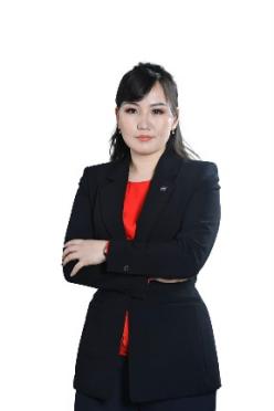
Enkhjargal Natsagdorj
Mongolian Geospatial Association
Ulaanbaatar City Municipality, Mongolia
Dr. Enkhjargal Natsagdorj graduated from the School of Agrobiology at the Mongolian State University of Agriculture with a degree in Land Management Engineering between 2004 and 2008. From 2008 to 2010, she earned her master’s degree in Remote Sensing and Geographic Information Systems from the School of Physics and Electronics at the National University of Mongolia. She worked as a lecturer in Geographic Information Systems at the Mongolian State University of Agriculture from 2008 to 2010, and from 2010 to 2019 as a lecturer at the NUM-ITC-UNESCO Laboratory for Remote Sensing and Geographic Information Systems at the School of Arts and Sciences of the National University of Mongolia. From 2017 to 2021, she studied at Ghent University in Belgium in the field of Geo-Informatics and obtained her PhD in Geographical Sciences with the dissertation titled “Determining Soil Moisture of Mongolia Using Remote Sensing Methods.”
She has undertaken professional training in the People’s Republic of China (2011, 2022), the United States of America (2012), the Republic of Korea (2013), Austria (2015), Japan (2016), and the Netherlands (2023). She has published 15 papers in international journals with impact factors (IF) and more than 70 works presented at international and national conferences. She currently serves as Head of the Spatial Data Analysis Department at the Centre for Policy Research and Analysis. Her work focuses on applying GIS, remote sensing, and spatial data analysis to support evidence-based decision-making on urban and land development, including mapping and monitoring urban change, land administration, and environmental assessments. In addition, she contributes to science–policy and international collaboration through professional leadership roles in the Mongolian Geospatial Association (2021-now) and the Global Geospatial Mapping Association (2024-now) and previously served as Mongolia’s point of contact (2020-2024) for UNISEC-GLOBAL.
Extended Materials:
About the previous ISDE International Lectures
https://www.digitalearth-isde.org/list-34-1.html
About the Mongolian Geospatial Association
https://www.geomedeelel.mn/