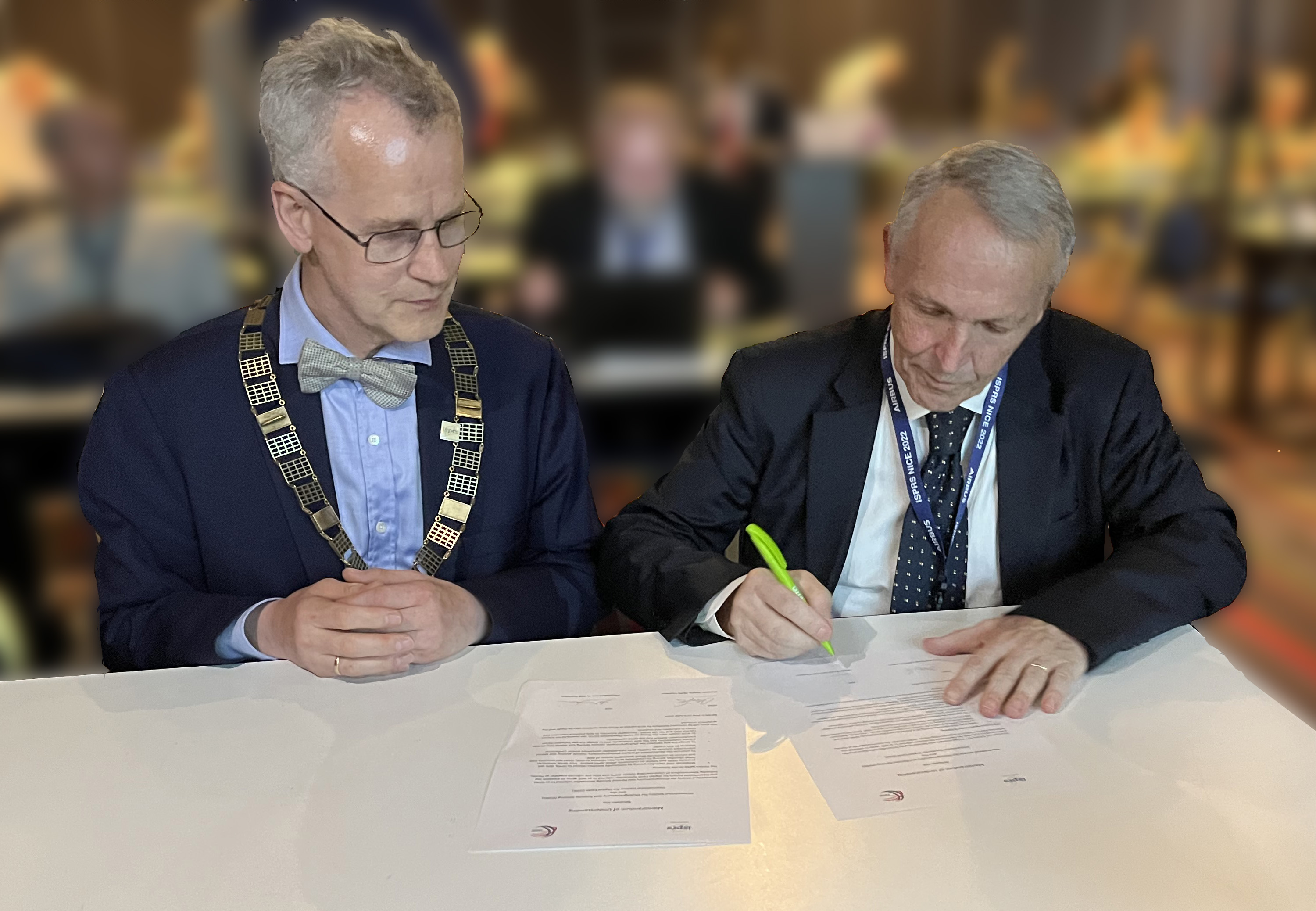
The International Society for Photogrammetry and Remote Sensing (ISPRS) and the International Society for Digital Earth (ISDE) signed on the 6th of June 2022 a Memorandum of Understanding (MoU) to further develop cooperation in the areas of Digital Earth, photogrammetry, remote sensing, spatial information, data science and other activities that they deem mutually beneficial.

Christian Heipke, ISPRS President and Alessandro Annoni, ISDE President signing the MoU
Such activities may include but are not limited to organise joint international workshops, conference sessions and publish special issues on respective journals when they see a common interest.
This collaboration aims to bring closer together the ISPRS community that is mainly focussing on photogrammetry, remote sensing and spatial information science and the ISDE community investigating all different aspects of digital transformation (technology, economy and society).
ISPRS and ISDE are both member associations of the Group on Earth Observation (GEO), the International Science Council (ISC) and the UN-GGIM - Geospatial Societies. Together they want to help promoting openness and ethics in education and research.
Christian Heipke, ISPRS President said "ISPRS is very happy to enter into this Memorandum of Understanding with ISDE. Information from imagery, and geospatial data are essential for global sustainable development. But, they need to properly be integrated into political and economic decision making to have an impact on issues such as global change, biodiversity, and environmental monitoring. This is where I believe the cooperation with ISDE has the potential to bring advantages for both organisations, their members and those using their results. While ISPRS is strong on the scientific side of data acquisition, data processing, algorithmic development, model formulation and data visualisation, we can learn from ISDE how to integrate these results with other data to create a copy of our Earth, namely the Digital Earth, to communicate these scientific results and transform them into tangible products and assets for the global community. In this way, we will be able to better contribute to the UN Sustainable Development Goals (SGDs).”
Alessandro Annoni, ISDE President remarked that: " One major advantage of international scientific collaboration is the ability of participating scientists to compare and contrast a broad array of methods across different countries and communities. Advances in Photogrammetry, Remote Sensing and Spatial Information sciences will provide new tools and data to better understand what happens on the Earth. When combined with socio and economic data and the use of complex models they become a key tool for understanding, modelling and predicting the dynamics of our planet as consequences of the different drivers. The International Society for Digital Earth is promoting the implementation of the Digital Earth vision aiming to develop a Digital Replica of the Earth addressing the changes in technology, science and society. The collaboration with ISPRS is a crucial step to follow the progress of their technologies but as well to better understand the possible impact on the economy and the society. This MoU is a further step in advancing collaboration and research on scientific disciplines that are relevant for both the Societies”.
About the International Society for Photogrammetry and Remote Sensing (ISPRS) https://www.isprs.org/
ISPRS, founded in 1910 in Vienna, started as a society dedicated to photogrammetry later combined with remote sensing and spatial information sciences. It organises dozens of events every year of various sizes. The society is scientifically led by five technical commissions. Their activities are split into sixty working groups each focused on a specific topic. ISPRS publishes twofold open access proceedings – The International Archives of the Photogrammetry, Remote Sensing and Spatial Information Sciences and the ISPRS Annals of the Photogrammetry, Remote Sensing and Spatial Information Sciences, and three journals - ISPRS Journal of Photogrammetry and Remote Sensing, ISPRS Open Journal of Photogrammetry and Remote Sensing and the International Journal of Geo-Information.
About the International Society for Digital Earth (ISDE) http://digitalearth-isde.org/
ISDE, founded in May 21, 2006, is headquartered in Beijing with its secretariat hosted by Aerospace Information Research Institute of the Chinese Academy of Sciences. The Society has two conference platforms: International Symposium on Digital Earth, and Digital Earth Summit. Since 1999, there are 20 events hosted in 14 countries in different continents. ISDE has 6 national or regional Chapters and 6 Working Groups to promote the worldwide development of Digital Earth. ISDE publishes two journals: International Journal of Digital Earth and Big Earth Data. The Society’s Manual of Digital Earth, co-edited by Prof. Huadong Guo, Prof. Mike Goodchild and Dr. Alessandro Annoni is a comprehensive work on Digital Earth.

2004-2026 All Rights Reserved 京ICP备06045536号-1 京公网安备 11010802041631号