ISDE International Lectures, organized by the International Society for Digital Earth (ISDE) are a series of online events which feature invited lectures by well-known international experts in the field of Digital Earth. The event will invite speakers to give lectures every two months. The purpose of the events is to bring international scholars in the relevant research fields of Digital Earth together to exchange academic perspectives, share research results, and disseminate the most cutting-edge and authoritative concept of Digital Earth.
The 8th ISDE International Lectures
The 8th ISDE International Lectures, with the theme of “Remote Sensing and Geoinformation for Natural Hazards Management and Disaster Mitigation”, will invite three speakers to provide their perspectives on the integrated Geoinformation-based methodology for spatiotemporal modelling, the application of advanced AI and remote sensing techniques to the wetland mapping, and remote sensing of seismic vulnerability.
Theme: Remote Sensing and Geoinformation for Natural Hazards Management and Disaster Mitigation
Date & Time: January 23, 2024, 13:30 - 15:00 (CET)
Organized by: International Society for Digital Earth
Co-organized by: Research Center for Digital Mountain and Remote Sensing Application, Institute of Mountain Hazards and Environment, CAS
Supported by: International Research Center of Big Data for Sustainable Development Goals
International Journal of Digital Earth
Big Earth Data
Invited Speakers:
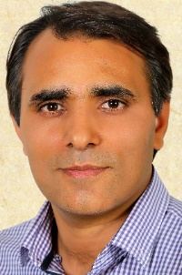
Bakhtiar Feizizadeh (University of Münster, Germany)
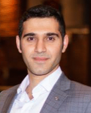
Meisam Amani(WSP Environment and Infrastructure Canada Limited, Canada)
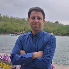
Sadra Karimzadeh (University of Tabriz, Iran; Tokyo Institute of Technology, Japan)
Moderator:
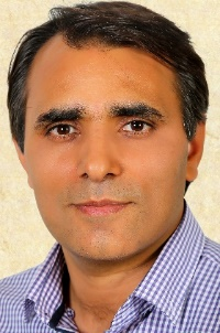
Bakhtiar Feizizadeh (University of Münster, Germany)
Programme:
13:30-13:35 | Welcome and Introduction |
13:35-13:55 | Topic: An Integrated Geoinformation-based Methodology for Spatiotemporal Modelling of the Environmental Impacts of Climate Change in Dying Lakes Basins Speaker: Bakhtiar Feizizadeh (University of Münster, Germany) |
13:55-14:15 | Topic: Wetland Mapping and Change Analysis in Canada Using Advanced AI and Remote Sensing Techniques Speaker: Meisam Amani (WSP Environment and Infrastructure Canada Limited, Canada) |
14:15-14:35 | Topic: Remote Sensing of Vulnerability: Damage Estimation of Karmanmaras Earthquake in Turkey 2023 Speaker: Sadra Karimzadeh (University of Tabriz, Iran; Tokyo Institute of Technology, Japan) |
14:35-15:00 | Group Photo Q&A |
Zoom:
https://us06web.zoom.us/j/86137027671?pwd=JOjW7BvBaupR3J1Q3TQ52JYpciWx9V.1
(Zoom ID: 861 3702 7671, Password: 110945)
Contact:
ISDE Secretariat (Email: isde@radi.ac.cn, Tel.: 86-10-82178912)
Short Bio of Invited Speakers:

Bakhtiar Feizizadeh
University of Münster, Germany
Dr. Bakhtiar Feizizadeh received the Ph.D. degree in Applied Geoinformatics from the University of Salzburg, Salzburg, Austria, in 2014. He is currently affiliated with the Institute of Geoinformatics at the University of Münster, Germany, and the Department of Remote Sensing and GIS at the University of Tabriz, Iran. Dr. Feizizadeh has also held positions at San Diego State University in California, USA, and the University of Münster in Germany. His main research interests include methodological issues in Geoinformatics, GIS based Multicriteria Decision Analysis, Uncertainty and analysis and thermal remote sensing image processing. He has been honored with the Alexander von Humboldt Fellowship for experienced researchers in Germany and has consistently been recognized as a highly cited top 2% scientist in 2021, 2022, and 2023.

Meisam Amani
WSP Environment and Infrastructure Canada Limited, Canada
Dr. Meisam Amani is the Remote Sensing Team Lead and the Key Specialty Leader of the Remote Sensing and Geospatial Technologies at a global consulting and engineering company, called WSP, where he manages and leads various industrial, governmental, and academic geospatial projects worldwide. He received his Ph.D. degree in Electrical Engineering from Memorial University of Newfoundland, Canada, in 2018. Over the past 15 years, he has worked on different applications of remote sensing, including but not limited to land cover/land use classification, soil moisture estimation, drought monitoring, water quality assessment, watershed management, power/transmission line monitoring, fog detection and nowcasting, and ocean wind estimation. To do these, he has utilized various remote sensing datasets (e.g., UAV, optical, LiDAR, SAR, scatterometer, radiometer, and altimeter) along with different machine learning and Big Data processing algorithms. Dr. Amani was an Associate Editor in IEEE JSTARS and the Guest Editor for several special issues in top Remote Sensing journals. He was also the recipient of the prestigious Professional Engineers and Geoscientists Newfoundland and Labrador Environmental Award in 2020 due to his contribution to wetland mapping in Canada using advanced machine learning and Big Data processing algorithms.

Sadra Karimzadeh
University of Tabriz, Iran; Tokyo Institute of Technology, Japan
Dr. Sadra Karimzadeh received a Ph.D. degree in engineering with a certificate of commendation from Kanazawa University, Kanazawa, Japan, in 2015. Currently, he holds the role of Assistant Professor in the Department of Remote Sensing and GIS at the University of Tabriz, Iran. He also continues his research fellowship with the Department of Architecture and Building Engineering at the Tokyo Institute of Technology, Japan, until April 2024. From 2016 to 2018, Dr. Karimzadeh served as a JSPS researcher at the Department of Architecture and Building Engineering, Tokyo Institute of Technology, Japan. In early 2019, he continued his research contributions at the Geoinformatics Unit, RIKEN. Subsequently, he held the position of TUBITAK visiting scientist at Gebze Technical University, Turkey, from September 2022 to September 2023. His research interests include SAR interferometry, radar imagery for earthquake damage assessment, infrastructure monitoring using SAR, GIS applications for disaster management, and seismic site characterizations based on GIS and remote sensing technologies. Dr. Karimzadeh is a reviewer for top international journals in remote sensing and earthquake engineering.
Moderator:

Bakhtiar Feizizadeh
University of Münster, Germany
Extended Materials:
About the 1st ISDE International Lectures, please visit:
http://www.digitalearth-isde.org/show-34-27-1.html
About the 2nd ISDE International Lectures, please visit:
http://www.digitalearth-isde.org/show-34-28-1.html
About the 3rd ISDE International Lectures, please visit:
http://www.digitalearth-isde.org/show-34-29-1.html
About the 4th ISDE International Lectures, please visit:
http://www.digitalearth-isde.org/show-34-30-1.html
About the 5th ISDE International Lectures, please visit:
http://www.digitalearth-isde.org/show-34-33-1.html
About the 6th ISDE International Lectures, please visit:
http://www.digitalearth-isde.org/show-34-36-1.html
About the 7th ISDE International Lectures, please visit:
http://www.digitalearth-isde.org/show-34-37-1.html

2004-2026 All Rights Reserved 京ICP备06045536号-1 京公网安备 11010802041631号